Western USA roadtrip
In summer 2019, we did a roadtrip in Western US. The purpose of this website is to share our quite unusual travel route.
If you don’t see HMTL, click here.
The route
Summary
We were mostly interested in the south-western national parks (Yosemite, Grand-Canyon, Death Valley) but definitely did not want to miss out on Yellowstone, the greatest and oldest of all nationalparks. Being constrained by arriving and departing in San Francisco, we realized that our initially planned trip added up to almost 7000km, not really pleasant and feasible in 3 weeks… Fortunately, Amtrak, the american railroad corporation, maintains the California Zepyhr, a daily train that connects SF and Chicago in a stunning, 50-hour-trip. The insight is that the Zephyr passes through Salt Lake City which serves as an ideal starting point for a road trip into Yellowstone.
So our roadmap, was to fly to San Francisco, then take a 17-hour-train ride to Salt Lake City (which only cost about 70$ p.P.), then rent a car there (a Kia Soul), drove it for almost 3 weeks and about 5500km and returned the car in San Francisco.
We camped almost every night, either sleeping in the car or in a tent. Check out the WikiCamps App, you can find information and location about campsites there, and also filter for free camping.
We visited the following national parks:
Images:
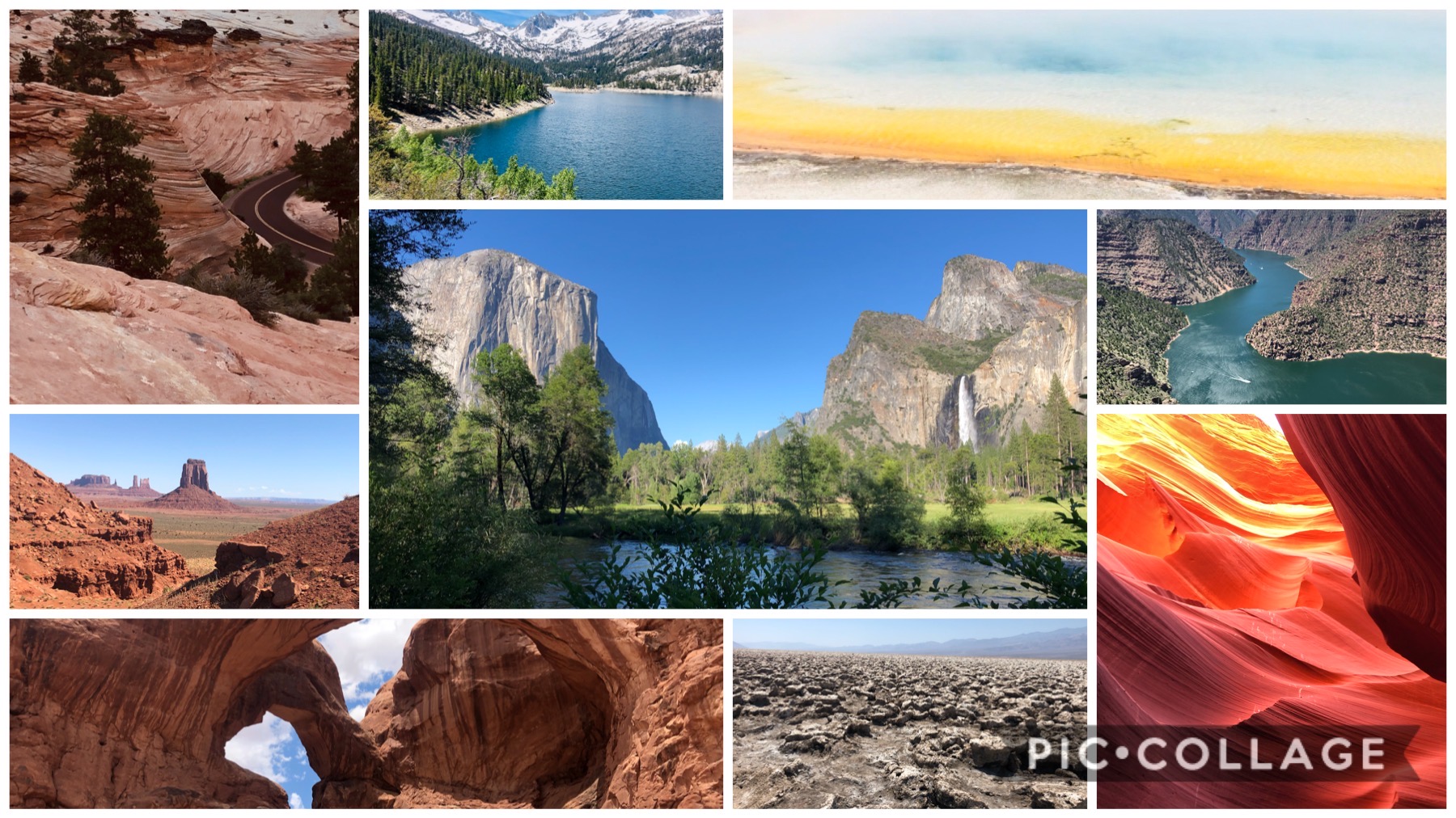 Please click here to get to the Drive folder with the best images :)
Day-by-day:
Day 1: San Francisco (CA) - Salt Lake City (UT)
Our key trick was to go to SLC by train, because this was the only way to see Yellowstone NP and all south-western NPs in just three weeks. The train ride is an experience on its own, passing through the mountains West of SF (we even saw some snow!) and then the vast desert of Nevada. There are sleeping cars and most importantly, there is a panorama car where the windows are huge and seats are turned towards the windows.
After a 17-hour-train ride (for about 70$ p.P.) we arrived to Salt Lake City, where we slept a few hours at SLC airport before the actual start of our roadtrip.
Day 2: Salt Lake City (UT) - Alpine (ID)
On the first day we hit the road and cover quite some distance to get to the national parks in the north. We shortly stop at Logan River, a small river with many fisherman. Then the road winds up the mountain and suddenly we are 2300 meters high, and enjoy a great view of Bear Lake from a viewpoint high above the lake. After driving down to the lake and the close-by town Garden City, we stop there for picknick and the famous raspberry shakes they sell there. Our route further passes through whole Europe - Montpelier, Geneva, Paris and Bern, before we reach Alpine, the spot of our first campsite. You can drive on a small bumpy road along the southern side of Palisades Reservoir and find a spot there right by the lake for free camping.
Day 3: Alpine (ID) - Rockefeller State Park (WY)
Wyoming appeared to us as the state closest to all Wild Western movies. In Jackson, half of the shops are made for Cowboys, with a large collection of cowboy hats and lots of gear, for example bear spray which is recommended to carry on the trip further to the north. In Jackson there is also a park with gates made of antlers.
After Jackson we reach the first national park on our trip, Grand Teton. The drive itself is amazing, crossing the plateau with snowy mountains on the side. There are several nice hikes, for example we walked to Bradley and Taggart Lake. We visited in June and it was still very snowy, but if it is possible, it would probably be a great tour to walk up Paintbrush Canyon and back through Cascade Canyon. We left Grand Teton and camped right outside in Rockefeller State Park, there is a parking lot close to a lake were several people parked their cars and campervans.
Day 4: Rockefeller State Park (WY) - Yellowstone NP West Entrance (WY)
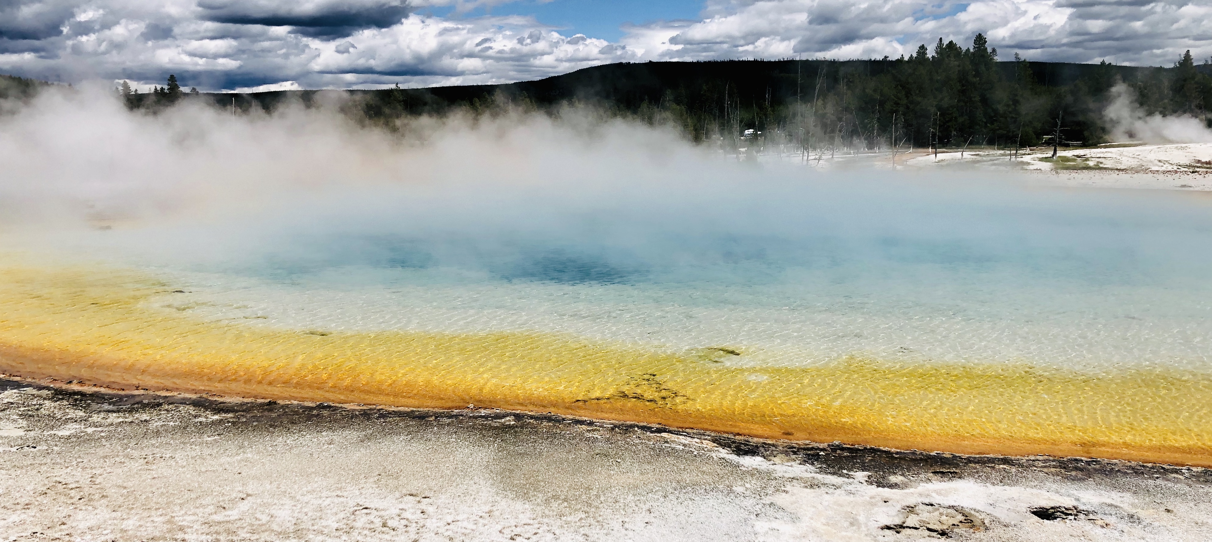
Although Grand Teton was impressive, Yellowstone is a different level because there are not many vulcanic areas in the world that you can visit. For example, Yellowstone is one out of four places in the world with active geysires. Most importantly, Old Faithful geysir erupts quite regularly every 90 minutes in is spectaculous. For the drive through the park you should plan some time, because there is stops every few kilometers with hot springs, bubbling mud pools, geysires and lakes.
We drove west on the 8-shaped loop, and visited Old Faithful, Grand Prismatic Springs, Biscuit Basin and Lower Geysir Basin. We also did a 2h hike to Fairy Falls where you can get a beautiful view on the whole park, with dense forests interrupted by volcanic areas. In the evening we camped on Madison campground. Note that you have to reserve around one day in advance (and during holidays probably more).
Day 5 Yellowstone NP West (WY) - Yellowstone East (WY)
Apart from volcanic formations, a main attraction in Yellowstone are the animals. We saw a lot more of them in the northern part of the loop drive, starting with some bisons and Waipiti, and one wolves on this day. We had breakfast at Norris Geysir Basin with the Steamboat Geysir, and after some smaller stops we reached the north entrance of the park. Even after seeing lots of hot springs until then, we are amazed by the Mammoth Hot Springs which stand out because of their terrace formations, building cascades of colourful waterfalls.
We shortly left the park through the north entrance for a visit to Montana and the city Gardiner, where we were back to civilization for a bit (there is hardly any mobile network connection in the park). Continuing our ride through the park, we were lucky to see a couple of black bears close to the Petrified tree. In the evening we climbed down a track at the Tower Falls to a nice little riverside place. We camped not far from the East Entrance at Canyon Campground.
Day 6: Yellowstone East (WY) - Cody (WY)
Before leaving Yellowstone, we visit its last attraction, the Grand Canyon of Yellowstone. Although not comparible in size with the real Grand Canyon, it offers amazing views of beautiful waterfalls on sand-coloured rocks. We took a round trip track of around 2h along the Canyon and then back through forests and along lakes, where it can happen that suddenly there is a bubbling mud pool to the side of the path.
At east entrance some bisons watch from the side of the road how we are leaving Yellowstone and head towards Cody, the ‘Capital of Rodeo’. When planning our trip, we considered going back to the south via Jackson again, because driving through Cody and Thermopolis adds quite a few kilometers, but in the end we decided for Cody because we wanted to see some more of Wyoming. Our hopes were fulfilled - In Cody we felt like in a Western movie. In the evening we went to see a rodeo in its most authentic version, and afterwards we went to Buffalo Bill Bar, had a Whiskey and talked to one of the bull riders. Coming from Europe, Cody is as cliché wild west as it can get.
Day 7: Cody (WY) - Green River (WY)
Although it is rather a road trip day with a long distance, we get to see several unusual sights on the way. First, we stop in Thermopolis, which demonstrates the vastness of the vulcanic area in Wyoming with some more hot pools. The secret tip there is to use the free public baths with water heated from geothermal energy (we appreciated that a lot after camping and bathing in lakes for a few days). Secondly, we take a short detour from Lander, a town at the edge of Wind River Reservation, a huge Indian reservate. A 20 minutes drive takes us to Sinks Canyon State Park which has a truly fascinating sight: At one point in the park, a river vanishes underground, to re-appear a few hundred meters further out of nowhere. It has only been shown by colouring the water that both are connected, but no ones knows the path the water takes underground.
Last, we stop in South Pass City, a ghost town. You can stroll through the street in the evening on your own, reading about the gold rush, or take a guided tour during the day. Finally our trip takes us to Green River where we were lucky to visit a random party of ‘‘Flaming Gorge Days’’ and dance with some teenagers.
Day 8: Green River (WY) - Arches NP (UT)
We drive a long distance on that day because there is a vast area in Utah with not many major attractions, but still very nice viewpoints and smaller spots on the way. Actually it is worth taking some more time for Flaming Gorge, a beautiful canyon with red rock faces and lots of green areas around. We drive along the west side because it is the more scenic drive, and stop at a couple of viewpoints and take a short walk that takes us to a great photo spot right at the cliff.
Our route continues to more monotonic landscape through the desert, where there is lots of turnouts to oil industry. We stop in Vernal, and drive west to see a little bit of Colorado. The landscape changes dramatically after the small town Dinosaur, it is hilly and a lot more green than around Vernal. Finally, we reach our destination north of Arches NP, where we set up our camp in the flat and very windy desert. After our tent was almost blown away, we changed plans and slept in the car.
Day 9: Arches NP (UT) - Manti La Se National Forest (UT)
In our visit to Arches NP we were kind of proud of a major trick we came up with - Instead of entering the park through the main entrance, and taking the dead end road into the park, we discovered a smaller dirt road where you can enter the park from the north. This had several advantages: You do not have to drive the same route forth and back into the park, and also, you pass some nice attractions which are not as crowded as the other sights along the main road (because you can only access them via the dirt road). We did not have a 4WD car and it was still fine, possibly depending on the season though. We stopped on the way at Tower Arch which you can reach via a short hike through the red rocks, shaped extraordinarily by erosion. You can climb up Tower Arch and get a great view, and the best part is that there were hardly any other people.
Along the main road through the park there are a lot more such formations, including Landscape Arch, Devil’s Garden, Fiery Furnace and so on. Most of them are close to the road, so we actually just spend a few hours in the park, although it is of course possible to stay there a lot longer when you want to do all the walks and see all arches.
We continued south, towards Monument Valley. We decided to take some stops at smaller and less well-known places on the way, including firstly the Manti La Se National Forest where you can cool down from the hot days in the deser, enjoy some mountain views and set up camp for free in the forest.
Day 10: Manti La Se National Forest (UT) - Monument Valley (AZ)
Instead of heading south to Monument Valley directly, we spontanously take a detour to the National Bridges Monument. As it is not as popular (surrounded by Monument Valley and a few national parks), we did not expect much, but it turned out that it was completely worth it going there. In this arrea the river carved a beautifully curved canyon into the landscape, leaving thin bridges overhead. We can recommend to hike down into the canyon at one of the three bridges, and follow the dried river until you reach a second bridge where you can get back up to the road. In total it takes around four hours to do a return trip.
After visiting the bridges, our navigation system tried to send us back the way we came, to drive south on the highway. To avoid this lengthy drive, we decided to take the risk and go south, on a small bumpy road. Again, it was totally worth it - you get an awesome view from high up the cliffs onto the spurs of Monument Valley and some palace-like rock formations. The road is called Moki Dugway and winds down the cliff with spectaculous views of the Valley of God.
Don’t miss out the Mexican hat monument close to the village of the same name, before entering Monument Valley where we arrived in the evening and enjoyed the sunset in this very special place.
Day 11: Monument Valley (AZ) - Page (AZ)
In the morning, the sun rises right above the monuments. Luckily, we were able to borrow bikes from a local (unfortunately there is no officiel bike rental so far), and went around the 13-miles-drive through the valley by bike. All the formations are quite different, and each time we were again astonished to see what nature is able to form.
We left the valley and headed west towards Page. On the way, we stopped at Navajo National Monument where you can visit an archaelogical site and learn about ancestral people living in the area. Right before Page, we reached another attraction which we could visit right before its closing in the evening: Lower Antilope Canyon. Even after seeing all the formations in Monument Valley, we were still completely amazed by this one. Just walking through the narrow canyon, where the light makes the walls shine in red and orange, is an incredible experience.
Although the day was already full of impressions, we took our dinner to another canyon named Horseshoe Bend to see the sunset. We slept in a motel in Page to finish this day with a shower and a nice soft bed.
Day 12: Page (AZ) - Grand Canyon (AZ)
After the first night of the trip that we spent under an actual roof, we continued our journey the next morning towards the Grand Canyon. Aiming for the north rim, the less crowded but not any less mindblowing side of the canyon, we passed by Lake Powell and a bison herd that was scared up by the chihuahua of an inconsiderate tourist. We were so fortunate to arrive right on time (early afternoon) to hike down into the canyon towards the Colorado River. Hiking through the Grand canyon (from one rim to another) is extremely demanding and cannot be done in a single day unless you are really crazy. It involves a steep descent of about 1500m through 5 vegetative zones down to the river, followed by a never-ending ascent all the way up to the other rim. After a brief conversation with a local ranger, we decided to use the afternoon to hike 1300m down to the Cottonwood campground, the only possible overnight-stay for hikers in the Canyon. We had a lot of respect from this hike (some people actually die by hiking into the canyon without enough water) but it actually turned out to be much simpler than expected. We packed a shitton of water which was good since all fountains til the campground were closed. The campground itself has no electricity, no water toilets and is not permanently maintained, it’s just a collection of flat spots to put up tents (believe me, you are very thankful for any flat spot there). To reduce weight, we hiked down without a tent but only with blankets and camping mats. It was dry and hot and the starlit sky was damn impressive so this turned out to be a smart decision although the rustling of the roaming animals during the night was a little frightening.
Day 13: Grand Canyon (AZ) - Springdale (UT)
Way before the sunrise, we started our hike back up to the North rim at 5am. It is recommended to not hike the Grand canyon between 11am and 3pm since there is no escape from the baking sun. We returned to civilization (tourist center at north rim) by around 11am and after a short exploration of the crowded touristy spots, we headed off to the Cape Royal Point to see Angel’s Window, a spectacular viewpoint with a 270 degree panorama into the canyon. The most delicate thing about Angel’s Window is that it is the only point along the north rim where you can actually see all the way down to the Colorado river (remember that over the milleniums the river has milled 1700m down into the soft sandstone of the Colorado plateau, so it’s not trivial to see a river at 800m when you stand at 2500m at the rim). Although this is a ~25mile one-way route, it is absolutely worth it. Afterwards, we leave the Grand canyon area and drive towards Zion national park. Zion welcomes us in the late afternoon with eroded, widely curved rock formation, yet another form of erosion we haven’t encountered before. We sleep in the car in Springdale on a parking lot.
Day 14: Springdale (UT) - Las Vegas (NV)
Zion National Park is a gorgeous place, with the Virgin river winding through a canoyn of colourful sandstone cliffs. You are not allowed to drive by car yourself, but need to take the shuttle buses. If we have had more time, we would have rented bikes - the bus route through the park is not far, so it is definitely possible to see the same sights as with the buses. If you take the bus, make sure to start early - we arrived at the bus stop at half past 7 in the morning and had to wait for an hour.
In Zion, there is a very special hike at the dead end of the bus route: The Narrows is a walk through the water, where you get wet up to your hip. It is possible to get proper water shoes and poles at the park visitor center. We followed the track (unprepared and barefooted) into the canyon, getting some wonderful views of the narrow river between massive granite walls. We went back in a hop-on-hop-off fashion by bus, walking some shorter tracks, for example to the Emerald pools. If you have enough time, it is supposed to be very nice to hike up the Observation Point Trail, to get a bird’s-eye view of the park from the top of Angels Landing.
In the evening, we arrived in Las Vegas. Although we planned the trip day by day, we managed to arrive in Vegas on Independence Day, certainly the best place to celebrate this day and take a deep dive into the true American culture. After two weeks of nature, the city feels even crazier than it is anyways. We went to the Strip in the evening, watched the dancing water fountains at the Bellagio Hotel, the fake volcano eruption and the fireworks for 4th of July. Then, the evening went just as expected when you go out in Las Vegas, without going into detail here. You don’t even have to waste lots of money gambling - We had more fun playing Mario Card, The world’s largest Pacman and riding the superman-style Zipline above Fremont Street.
Day 15 - Las Vegas (NV) - Desert, Mountain Springs (NV)
The next day was, what a surprise, characterized by hangover. Vegas Hotels definitely know how to serve hangover breakfast - lots of chips, cheese, bacon and fried eggs. After several liters of “Arizona” (cheap and refreshing drink) and a 1h nap in massage chairs in the middle of a shopping mall. With the breakdown of the alcohol in our blood, the absurdness of Vegas becomes sharper and crispier. We escape from the city in the late afternoon and sleep next to the highway in the desert in mountain springs. Even though the sun sets in the West, the brightest point of the sky in the evening is clearly in the east; light pollution from Vegas.
Day 16 Desert, Mountain Springs (NV) - Independence (CA)
We are returning to California. We come to realize that we visited 9 states in only 16 days but still never felt rushed and truly enjoyed the landscape. Despite Vegas itself not known as a cold pole of our planet, temperatures keep increasing on our way into the death valley. We agree to challenge ourselves to not turn on the AC for the entire day (we made it, it’s not so bad, you just have to carry enough water, open the windows and accept sweating). Death valley is a place of superlatives. First, it is planet earth’s heat pole, in 1913, it was measured to be 57 degree celsius in the shade (for us it was a jittering 49 degree celsius only). Secondly, it is the driest spot in northern america with only 5mm precipitation per year. Thirdly, it contains badwater basin, the lowest point of north america (-86m) which is also the origin of the great basin, an endorheic basin (this means that precipitation falling on this land does not stream into the ocean). Yet, the highest mountain of the contiguous 48 states is only 136km away. We’re mentioning these facts so that you understand that death valley is a truly unique place, which does not imply that it is always pleasant to visit. Everything is called dry X here: After visiting a dry river (only carries water during flash floods), we do a small hike into the dry canyon, before visiting the dry lake. Still the most hilarious “dry X” is the dry waterfall we visit on our way out of the park. Another highlight is Artist’s palette a colorful rock formation that brings to light several metals (iron, magnesium, aluminium, titanium). After crossing a quite massive mountain chain to leave the death valley (Telescope peak is > 3000m high and has an upper and lower tree line), we sleep in independence and consider a hike for the next day.
Day 17 Independence (CA) - Bishop (CA)
Waking up in Independence with a view on the Sierra Nevada to our left, we try to spontanously organize a hike for the day. After we find out that you have to reserve campsites months in advance for the highest mountain of the US (without the ones in Alaska), Mount Whitney, we decide for Mt Agassiz, with a similarly impressive elevation of 4200 meters. Its top is supposed to be reachable in one day, since you can drive up to 3000 meters already, to the sparkling South Lake. We early realize that we started too late to reach the top, besides very snowy conditions which make it impossible to climb up the top anyways. Our goal became to reach Bishop’s Pass, which marks the border between Ingo National Forest and King’s Canyon NP.
Even then, we are not sure whether we would be able to reach it. Soon there is lots of snow around us, and we have to walk across snow fields which dangerously pass above small creeks. One time, we even have to jump over a creek. Several times we consider to go back, but with a bit of adventurous spirit we continue, and tackle the last snowy ascent, where we sank into the snow up to our hips. Poles are highly recommended! After all these challenges, we finally reach Bishop’s pass at 3600 meters, where we find a lovely view on the snowy mountains on the other side, as well as a ‘‘Welcome to King’s Canyon National Park’’ sign.
On the descent, we realize that hiking up to 3600 meters, straight after our visit to Death Valley at -84m, is not a good idea. Mountain sickness is quite dangerous, and one of us was suffering of a strong headache and sickness. While trying to hike down as fast as possible, we also managed to get lost (we did not have a map), and to get back to the track, we have to climb down the scree, whack through some bushes to avoid a wider creek, and balance over a fallen tree to pass another one. Finally, we get back to the track and soon we reach South Lake, where we take our car and drive down to 2000m as quickly as possibe. There, the sickness soon disappears and we hungrily devour a burger at a pub in Bishop. We park our car in the municipal park and sleep there.
Day 18 Bishop (CA) - Mono Lake (CA)
After all the excitement of the previous day, we take a break and relax, read and update our travel notes in the park in Bishop. Finally at lunchtime we start heading north, towards our next stop Yosemite. On the way, there are some smaller sites worth to check out: Mammoth Lakes and Whitmore Hot Springs, both gorgeous places. North of Mono lake then there is a ghost time that is one of the most popular ones, called Bodie. You can take a tour and see many buildings of the old gold miners. We slept at Mono Lake, in our car parked in the Mono Lake Parks to its north, a nice place to see some rare birds.
Day 19 Mono Lake (CA) - Yosemite NP (CA)
We are very close to the famous Yosemite NP already, and on this day we finally enter it via the Tioga Pass. When planning your travels, make sure that the Tioga Road is not closed - when we got there, we found out it was only open a week before because of the late winter, and if it is closed you’d have to go all the way around the mountains. But if it’s possible, it is very worth it: It is a scenic drive up to 3000m altitude, then you pass Ellery Lake and Tioga lake, two beautiful mountain lakes. Soon you pass another popular viewpoint called Tuolumne Meadows. In general, this part of Yosemite is totally different from the popular part of the park, the Yosemite Valley. In contrast to the loop in the valley, Tioga Road is on high eltitude, there are not as many people, and there are many great hikes starting there.
We decided to do one of those hikes, where you only need to get a camping permit (for free) and a big box to store your food to keep it from bears. Our choice was the track starting at the Porcupine Creek Trailhead, because the hike actually leads towards the cliffs, such that you get the special view of Yosemite valley from above. We walked around 25km through the forest, on a nice but rather flat track, only interrupted from one part where we had to cross a creek with the water as high as our hips. Suddenly we reached the edge and get an amazing view of the granite rocks surrounding the valley. One turn later we reach the Yosemite Falls viewpoint, where you can stand on platform right next to the waterfall dropping 700m. With this reward for our hiking efforts we happily set up camp a few kilometers further along the cliff, and sit around our campfire for a while.
Day 20 Yosemite NP Tioga Road (CA) - Yosemite Valley
At night we wake up several times thinking that there is an animal around the tent, but in the morning our bear-safe food box is in the same place, and we are still alive. Hiking along the ridge in the morning hours is gorgeous, and we take a short detaur to walk until the edge of North Dome overlooking the whole valley, and with great views of the Half Dome on the opposite site. The track then leads back into to forest towards Tioga Road, where we hitchhike back to the parking lot to avoid walking along the road for the last few kilometers.
On the car ride to Yosemite Valley there is another stop that you should not miss: In the so-called Tuloumne Grove we saw the Giant Sequoias, massive trees with a height of up to 90 meters. We were highly impressed and almost intimidated by the power of nature, preserving these trees for 2000 years through wood fires and diseases. You can even walk through the stump of a fallen tree, where a shape as big as a car has been cut out, and crawl through the trunk of another one.
When we arrive in the valley in the evening, the sun is illuminating El Capitan and the massive granite walls surrounding the valley have an even stronger effect than from above. We fill up our water at Fern springs, a secret tip from some locals - the water is a lot more tasty than from the tab. We decide to explore the valley the next day by bike and sleep in our car on the visitor center parking lot.
Day 21 Yosemite Valley (CA) - Stanislaus National Forest (CA)
The loop in Yosemite Valley is of perfect length for a bike tour. We picked up the bikes in Curry Village and started the tour. It didn’t take long until we left out bikes locked for the first time to go for a hike, namely at the Happy Isles Trailheads. The start of the John Muir Trail leads to the beautiful Vernal Falls, which are a must-see in our opinion. Although not as high as other waterfalls in the valley, the advantage is that you can get really close, such that you are completely wet from the sprinkling water after passing them, and we took postcard-like pictures with a colourful rainbow in the background. It is possible to climb up to the top of the waterfall and relax at the Emerald Pools, where swiming is of course prohibited. We decided to take a round trip over Clark Point to get back to the road, where we enjoyed some more views of the valley and the torrential river.
Only five minutes later we reached the next turnout to the Mirror Lake. We took a lunch break there and had a bath in the cool water. Afterwards we had a longer bike ride through the more populated area of the park, until we reach Camp 4, a place that became even more famous with the Free Solo movie. Once more we leave our bikes and take the short hike to the starting point for climbing El Capitan. Failing miserably even at just clamping on the granite wall, we were even more astonished of the idea to climb up without a rope.
In the shine of the evening sun we shortly visited Bridalveil Falls, and then gave back our bikes. We used the evening to cover some of the distance to San Francisco, leading through the outskirts of Stanislaus National Forest. We sleep in a small town simply in our car.
Day 22 Stanislaus National Forest (CA) - San Francisco (CA)
The last day of our trip starts in the backland of California, at the calm and remote Stanislaus river. We decide to indulge our shared interest in Tech and software and spend the day in the Silicon Valley (Mountain View) and visit the Google Campus. The campus is impressive, there’s a volleyball pitch, own residencens and free bikes to cruis around - actually the campus is so big that we loose each other for almost 30 minutes (fail of the day!). We can highly recommend the Computer History Museum which is quite inexpensive (15$) but offers enough content to easily spend 3h and learn about the history of computer science. We then spend the last evening at the Shoreline park, right next to the Google headquarters. Only slowly we are realizing that our adventure now comes to an end. Overall, we are incredibly thankful for having had the privilege to do this wonderful trip and we were and still are super satisfied with the travel route and decisions we’ve made.
All the best & stay safe, Jannis & Nina